


| basics |
Google
Earth® allows creating KML files,
that allow placing bitmaps on top of Google Earth´s
satellite image surface. |
|
| example GE screen | 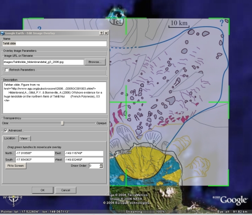
|
The below file is an example of a small kml file to display a map on top of the satellite image surface.
minimum kml file for placemarks multiple placemarks in one file defining buildings in a kml file fix if kml-files from your server do not open in GE watch and play route in Google Earth fix
if Google Earth does not connect to server
|
| example
file overlay.kml |
<?xml
version="1.0" encoding="UTF-8"?> |
xml
declaration header by default your bitmap will be centered and it will take 75% of the screen |
| tipps |
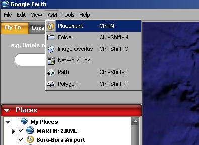
You
can easily create such a file by using Google
Earths Add - Image overlay function. GE will put
an image frame in the center of your screen and lets
you select a bitmap file. You can grab it the sides
with the mouse and change the size and even turn it .
To save it, use File Save As.. I suggest to use .KML
as a file format, since you can look at it in an
editor, and easily see and understand how the KML
syntax works. |
|