


| basics |
Google Earth® allows creating KML files, that may be used to show point locations, line arrays, polygons or bitmaps on top of Google Earth´s satellite image surface.This is a very easy way of showing sample locations, "georeferencing" (or maybe google-earth-referencing, since the georeferencing of the GE satellite images is not always precise) a geological map or just showing a friend where you live or where the BBQ tonight will happen... |
|
|
example GE screen
multiple placemarks in one file defining buildings in a kml file fix if kml-files from your server do not open in GE |
|
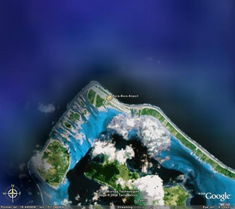
example
screenshot for the below KML file for a simple
placemark. you can either download it from the link or copy and paste the lines into the Windows plain text editor (Notepad) and save it as borabora.kml (not borabora.kml.txt.... switch file type from text files to all files in the save as window). If you have Google Earth® installed, double clicking on borabora.kml either from this server or from your computer should open the program and display the screen on the left. |
| minimum .KML file borabora.kml |
<kml
xmlns="http://earth.google.com/kml/2.0"> |
Leaving out all optional stuff this is a minimum file to display a standard icon and a placemark name at a certain place on (googles) earth and center the view on it. Without a view height (range) GE zooms very far down (1 km). |